Browse by Subject

Showing 1-20 of 27 Entries

Bay View

Bay View is a residential community in the southeastern section of the City of Milwaukee. Its borders are Lake Michigan (east), Morgan Avenue (south), Kinnickinnic River/Chase Avenue (west) and the Kinnickinnic River north of Becher Street (north). Bay View high has its own school, post office, library, historical society, community center, park, newspaper, neighborhood association,… Read More

Belgium

The Town of Belgium, located in the northeastern corner of OZAUKEE COUNTY, contains the Village of Belgium. The unincorporated communities of Lake Church, Dacada, Holy Cross, Decker, and Sauk Trail Beach are also within the Town of Belgium’s boundaries. Belgic LUXEMBOURGERS were among the first Europeans to settle the area in the late 1840s. According… Read More

Cedarburg

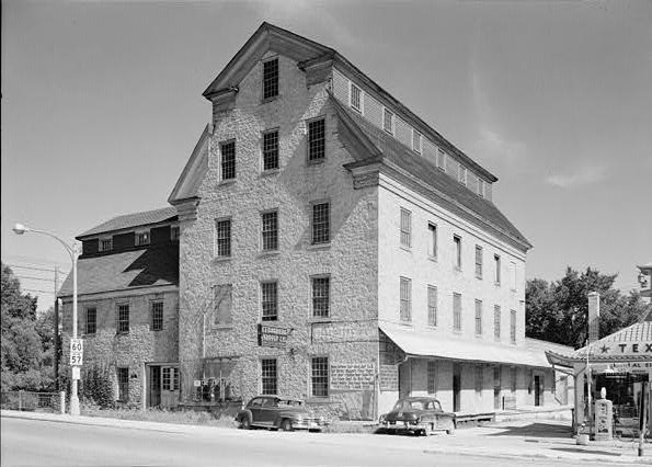
This photograph shows the flour mill built in 1855 in the heart of Cedarburg.
The City of Cedarburg is located in Ozaukee County approximately 20 miles north of the City of Milwaukee. Incorporated as a city in 1885 with a population of approximately 1,000 people, by 2010 the city’s population was 11,412. The Town of Cedarburg remains a separate entity that manages services such as parks and roads. Cedarburg… Read More

City of St. Francis

At 2.55 square miles, the City of St. Francis is one of the smallest suburbs by area in MILWAUKEE COUNTY. According to early white settlers, native residents called the area “Nojoshing,” possibly meaning “strip of land extending into the water.” When the territorial government divided Milwaukee County into townships, Nojoshing became part of the Town… Read More

Cudahy

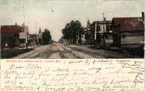
An early 20th century postcard of Packard Avenue, one of Cudahy's major streets.
Located in Milwaukee County, just east of Milwaukee’s southernmost portion, the suburban city of Cudahy was named for city founder and meatpacker Patrick Cudahy. Cudahy is bordered by St. Francis to the north, General Mitchell International Airport to the west, Lake Michigan to the east, and Oak Creek and South Milwaukee to the south. The… Read More

Delafield

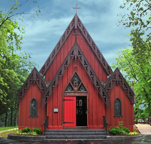
A 2009 photograph of Delafield's St. John Chrysotom Church, which is on the National Register of Historic Places.
The City of Delafield is a residential and resort area centered on Lake Nagawicka in the Lake Country area of Waukesha County. The Town of Delafield was created in 1842, allowing local government functions. Approximately 25 miles west of Milwaukee, Delafield was incorporated as a city in 1959. In 2010 the city’s population was estimated… Read More

Eagle

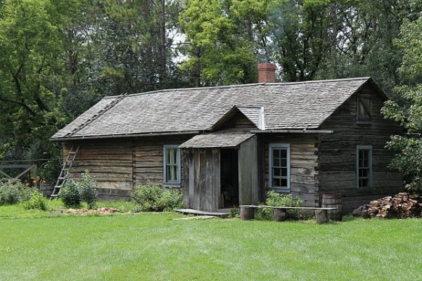
Old World Wisconsin reconstructs life in 19th century Wisconsin in a buildings that are clustered by ethnicity. This Finnish log house was moved from its original location in Oulu, Bayfield County, Wisconsin.
Eagle, Wisconsin is a community in the Kettle Moraine State Forest, about 35 miles west of Milwaukee. Eagle consists of two legal entities: the Town of Eagle and the Village of Eagle. Although they are legally separate, they are closely linked by shared official services as well as community history and recreational attractions. Like most… Read More

Franklin

Franklin originated as a heavily wooded, 36-square-mile frontier bordering Racine County and bisected by the Root River. It was inhabited by the Potawatomi and Menominee Indian tribes until the mid-1830s, when German, Dutch, and Irish immigrants began arriving to clear the land for farming. Milwaukee County put land up for sale at $1.25 per acre,… Read More

Fredonia

On June 14, 1885, the nation's first observation of Flag Day was held at Stony Hill School in Waubeka in the Town of Fredonia.
The Town of Fredonia is located in the northwestern corner of OZAUKEE COUNTY. The Town of Fredonia was created out a portion of the Town of Port Washington in 1847. The Town contains the Village of Fredonia and the unincorporated communities of Waubeka and Little Kohler. The Town of Fredonia was settled by GERMAN and… Read More

Greendale

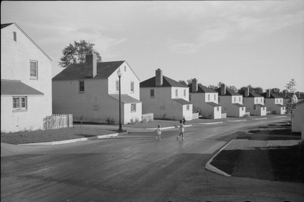
Children play on the street in this 1939 photograph of Greendale houses.
The federal government developed Greendale in 1936 as part of the Resettlement Administration’s (RA) Greenbelt Towns Program. Some historians, such as Paul Conkin, consider the greenbelt communities built under this program to be one of the most innovative New Deal initiatives. Resettlement Administration head Rexford Guy Tugwell is credited with the idea for these towns.… Read More

Hartford

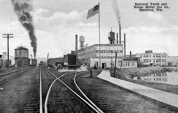
The Kissel Motor Car Company was a major industrial employer in Hartford in the early twentieth century.
Once a remote trading site along the Rubicon River inhabited by Potawatomi and Menominee peoples, Hartford has evolved over the past two centuries into a bustling center of industry, recreation, and civic engagement. The Town of Hartford was incorporated as the Town of Wright in 1846. The Village of Hartford incorporated in 1871 and became… Read More

Inner Core

In 1959, Mayor FRANK ZEIDLER called a public conference and assembled a group of community activists and researchers to discuss the “Social Problems of the Core of the City.” The group’s final report was issued on April 15, 1960. Titled “Mayor’s Study Committee on Social Problems in the Inner Core Area of the City” but… Read More

Racine County

Racine County was forged out of the original Milwaukee County on December 7, 1836. From the end of the Civil War to the 1950s, it ranked second in Wisconsin only to its northern lakeshore neighbor in total population, industrial development, and ethno-cultural diversity. Several of its manufacturing establishments achieved national—and even international—status. For several decades,… Read More

Riverwest

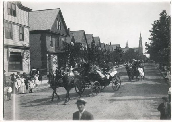
Carriages parade past Frank Burczyk Saloon on North Bremen Street in Riverwest.
Riverwest is a neighborhood in the city of Milwaukee bounded by the Milwaukee River on the east and south, N. Holton Street on the west, and E. Capitol Drive on the north. The neighborhood’s first development was at dams on the river in the mid-1830s—one located just south of present-day Capitol Drive, the other south… Read More

Town of Addison

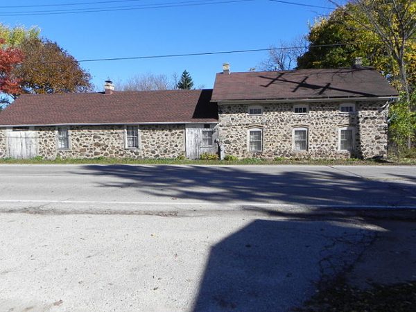
This 2014 photograph shows the nineteenth century Ritger Wagonmaking and Blacksmith Shop in its modern context.
Located in west-central WASHINGTON COUNTY, the Town of Addison borders Dodge County to the west, the TOWN OF WAYNE to the north, the TOWN OF HARTFORD to the south, and the TOWNS OF BARTON and WEST BEND to the east. Settled predominantly by Germans following the regional completion of the U.S. Public Land Survey, the… Read More

Town of Barton

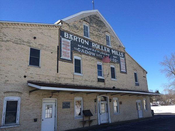
Milling activity, such as that which took place in the Barton Roller Mills, was a foundational business enterprise in Barton.
The Town of Barton occupies 19.5 square miles in WASHINGTON COUNTY, 37 miles northwest of downtown Milwaukee. The town is governed by a town board made up of five members. The town is home to the unincorporated community of Young America. The early histories of town and village of Barton were intertwined. The Village of… Read More

Town of Erin

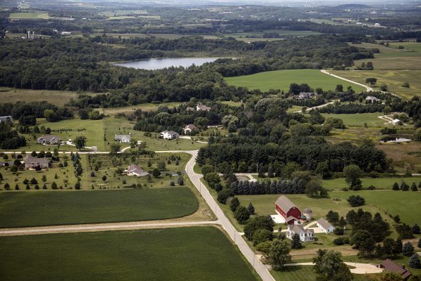
This 2016 photograph of the Town of Erin shows the combination of rural farms and modern housing that characterize its twenty-first century development.
Incorporated on January 16, 1846, the Town of Erin is located in the southwest corner of WASHINGTON COUNTY. The Town features one of the highest points in southeastern Wisconsin, an elevation of 1,330 feet above sea level. Perched atop this hill, overlooking hundreds of acres of natural hardwood forest is HOLY HILL, a minor basilica… Read More

Town of Farmington

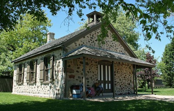
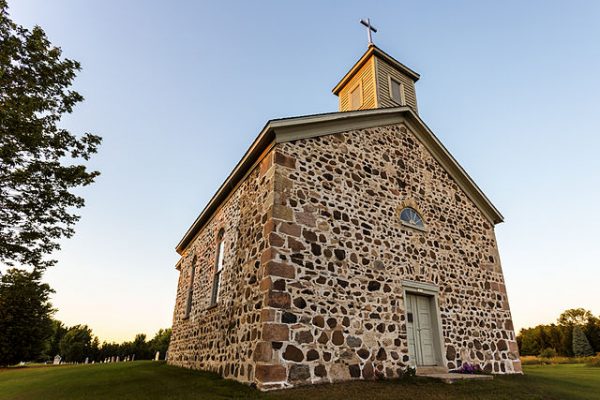
St. Peter's Church, an example of fieldstone construction, was built in 1861.
The Town of Farmington occupies the northeast corner of WASHINGTON COUNTY. It borders Sheboygan County to the north and Ozaukee County to the east. Originally, the Town of Farmington was part of the TOWN OF WEST BEND, though in 1847 an act of the state legislature set off a piece of land, first called Clarence.… Read More

Village of Bayside

Located along LAKE MICHIGAN, about twelve miles north of downtown MILWAUKEE, the Village of Bayside occupies the northern end of MILWAUKEE COUNTY’s lakeshore and extends into OZAUKEE COUNTY. The Village had a population of 4,389 in 2010 and a median estimated home value of $325,600 in 2014. An AGRICULTURAL and summer home region in the… Read More

Village of Big Bend

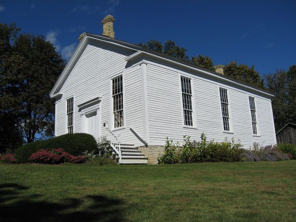
The Reformed Presbyterian Church of Vernon, in use for worship from 1854 until the 1930s and restored in the 1970s, is an example of Greek Revival architecture listed on the National Register of Historic Places.
The Village of Big Bend is located along the Fox River within the Town of Vernon, southwest of MILWAUKEE. Like much of WAUKESHA COUNTY, Big Bend and Vernon began as farming communities. The Town of Vernon was founded in 1839, while the Village of Big Bend was incorporated out of Vernon’s land in 1928. In… Read More